Sector F, Noida
+91 9891555001 / 9311475175
info@mytechpro.co.in
Infrastructure Inspection Services | MyTech Professionals

Infrastructure Inspection

Technology-driven infrastructure inspection using drones, high-resolution imaging, thermal cameras, GIS mapping and digital inspection solutions for better visibility and informed asset management.

Request Inspection
INFRASTRUCTURE INSPECTION

Smarter Inspection for Critical Infrastructure

MyTech Professionals provides digital infrastructure inspection solutions designed to help organizations collect, visualize and manage information about physical infrastructure and assets.

By combining drone surveying, high-resolution visual imagery, thermal cameras, GIS mapping and digital reporting, inspection teams can document site conditions and organize observations in a structured digital environment.

✔ Drone-Based Infrastructure Inspection
✔ High-Resolution Visual Inspection
✔ Thermal Camera Inspection
✔ Roads & Highway Inspection
✔ Bridge & Structure Inspection
✔ Building & Facility Inspection
✔ Utility & Asset Inspection
✔ GIS-Based Asset Mapping
✔ Digital Inspection Documentation
✔ Inspection Reports & Records

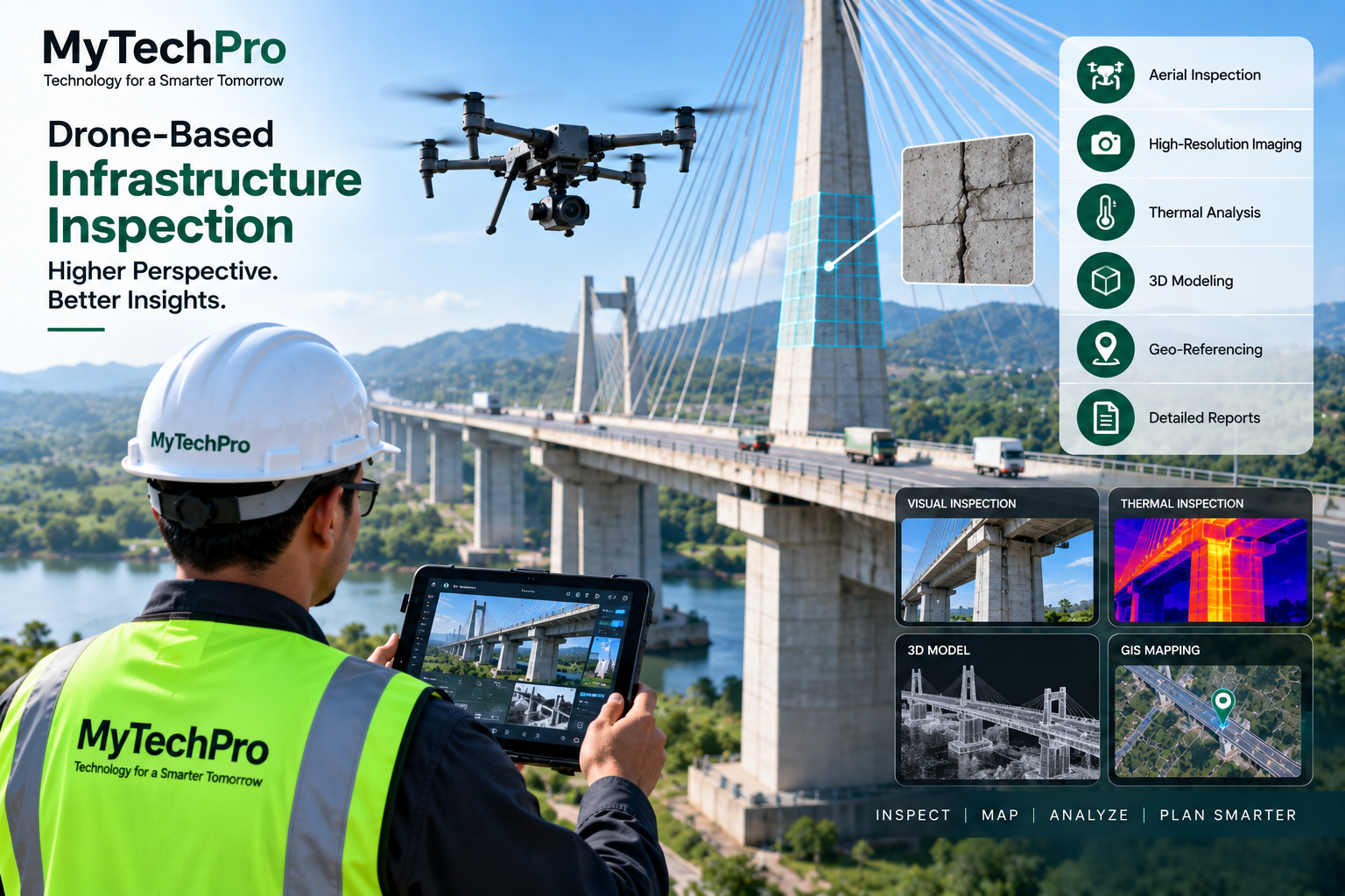
Infrastructure Inspection using Drone and GIS Technology
OUR CAPABILITIES

Infrastructure Inspection Services

A combination of visual, aerial, thermal and spatial technologies can provide detailed inspection information for different infrastructure environments.

Drone Infrastructure Inspection

Capture aerial imagery of structures, facilities, corridors and large infrastructure areas using suitable drone platforms.

Road & Highway Inspection

Document roads, highway corridors, structures and surrounding infrastructure through aerial and visual survey techniques.

Bridge & Structure Inspection

Capture visual information from bridges and structures to support inspection documentation and condition assessment workflows.

Thermal Inspection

Use thermal imaging to visualize temperature variations across selected infrastructure surfaces and equipment.

Building & Facility Inspection

Capture visual information from buildings, roofs, facilities and selected difficult-to- access areas.

GIS Asset Inspection

Connect inspection observations with geographic locations and mapped infrastructure assets using GIS technology.

Drone Infrastructure Inspection
DRONE-BASED INSPECTION

Inspect Large and Difficult-to-Access Infrastructure

Drone-based inspection can provide a practical method for capturing detailed visual information from large structures, elevated areas, corridors and locations that may be difficult to access.

Aerial imagery can be organized with geographic information and project records to support inspection documentation and ongoing monitoring.

✔ Aerial Visual Inspection
✔ High-Resolution Photography
✔ Video Inspection
✔ Difficult-to-Access Areas
✔ Large Area Coverage
✔ Geo-Referenced Inspection Data
✔ 2D Mapping
✔ 3D Infrastructure Modeling
VISUAL + THERMAL TECHNOLOGY

Add Thermal Imaging to Infrastructure Inspection

Thermal imaging can provide an additional layer of information by showing temperature patterns that may not be visible through conventional photography.

Solar Infrastructure

Thermal inspection of solar panels and selected solar infrastructure components.

Electrical Assets

Visualize thermal patterns around selected electrical equipment and connections.

Buildings

Thermal imaging can supplement visual inspection of selected building areas.

Industrial Assets

Thermal information can support inspection of selected industrial equipment and assets.

INFRASTRUCTURE + GIS

Map Inspection Data to Your Infrastructure Assets

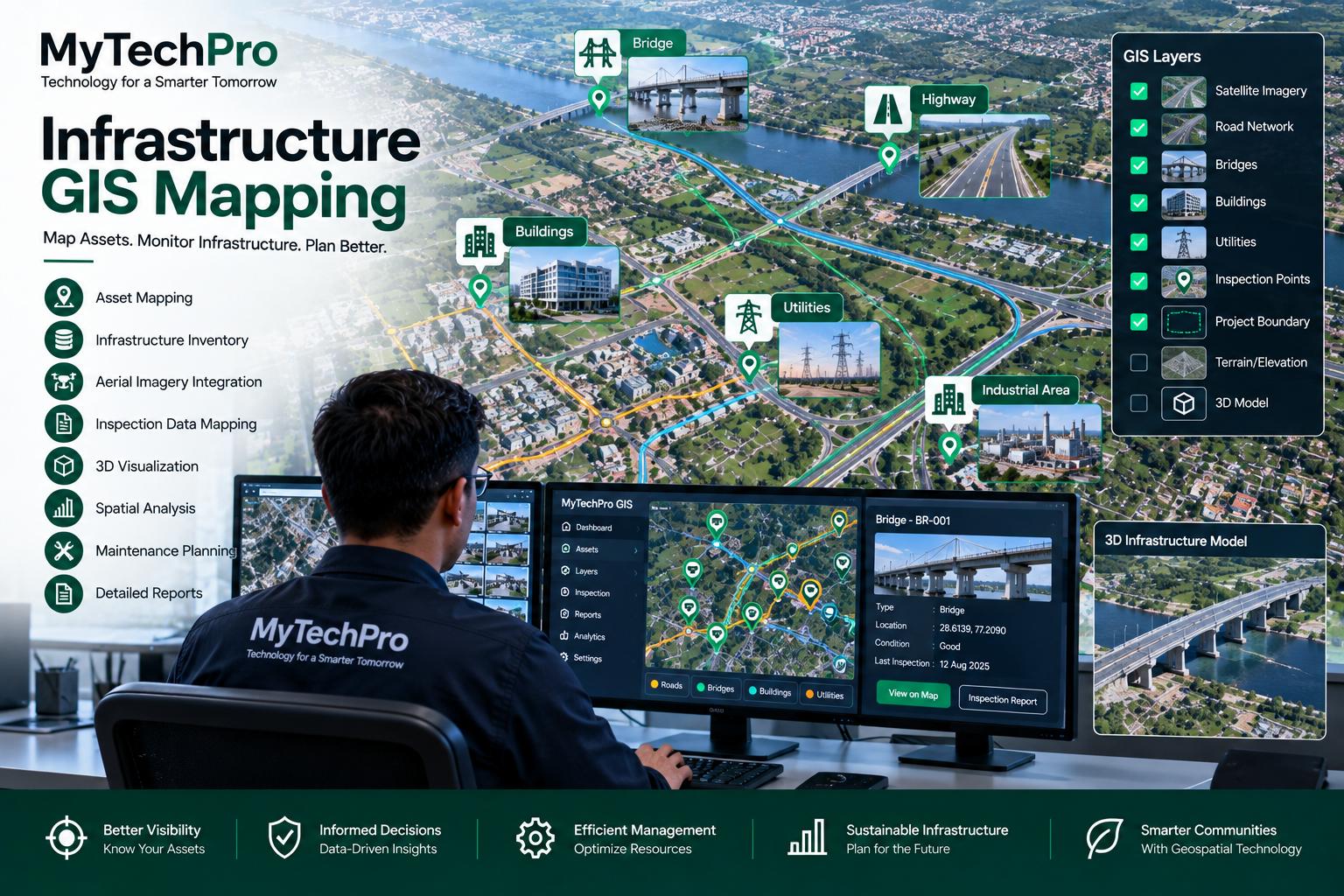
GIS provides a geographic framework for organizing infrastructure inspection information. Inspection observations can be associated with locations, structures, assets and project areas.

This approach can help organizations visualize infrastructure information on digital maps and maintain structured inspection records.

✔ Infrastructure Asset Mapping
✔ Geo-Referenced Inspection Records
✔ Camera & Drone Data Integration
✔ Thermal Image Location Mapping
✔ Asset-Wise Inspection History
✔ Interactive GIS Maps
✔ Spatial Asset Database
✔ Digital Inspection Reports
Infrastructure GIS Mapping and Asset Inspection
APPLICATION AREAS

Infrastructure Inspection Applications

Roads & Highways

Aerial documentation, corridor surveys and infrastructure monitoring.

Bridges

Visual inspection documentation and digital mapping of bridge structures.

Buildings & Facilities

Roof, facade and facility inspection documentation.

Utilities

Inspection and mapping of selected utility infrastructure and physical assets.

Telecom Infrastructure

Visual documentation and mapping of selected telecom infrastructure.

Solar Plants

Visual and thermal inspection of solar installations and associated assets.

Industrial Sites

Asset inspection, visual documentation and spatial mapping.

Construction Projects

Construction progress documentation, site inspection and aerial mapping.

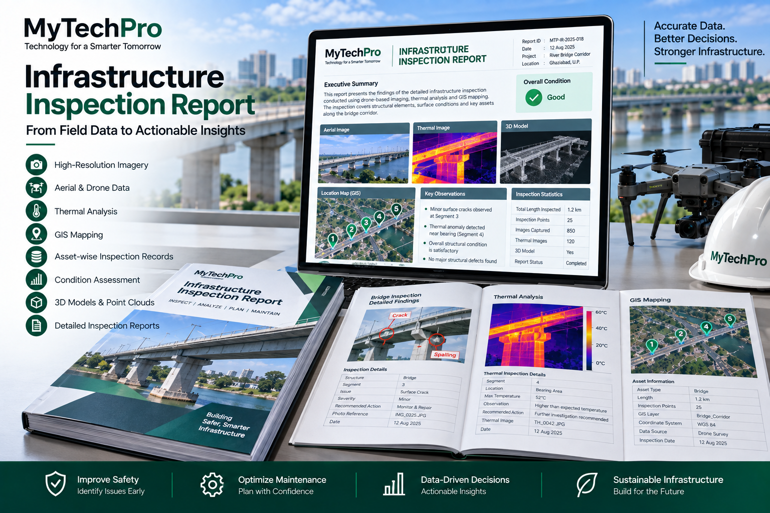
Digital Infrastructure Inspection Report
DIGITAL INSPECTION OUTPUTS

Structured Data for Better Asset Management

Inspection information can be organized into digital records, maps and reports to support project documentation and ongoing asset management.

✔ High-Resolution Images
✔ Aerial Inspection Videos
✔ Thermal Images
✔ Geo-Referenced Data
✔ 2D Digital Maps
✔ 3D Models
✔ Asset-Wise Records
✔ Digital Inspection Reports
OUR PROCESS

Infrastructure Inspection Workflow

A structured inspection workflow helps organize field data, imagery, spatial information and reporting requirements.

01. Plan

Define inspection objectives, assets, locations and required outputs.

02. Capture

Capture visual, aerial and thermal data using appropriate inspection equipment.

03. Map & Analyze

Organize inspection information with maps, assets, imagery and spatial data.

04. Report

Deliver structured inspection records, observations, maps and digital reports.

MYTECHPRO ADVANTAGE

Technology-Driven Infrastructure Inspection

We combine surveying, GIS, imaging and software technologies to help organizations manage infrastructure information digitally.

Drone Technology

Aerial data collection for large, elevated and difficult-to-access areas.

Thermal Imaging

Additional thermal information for selected inspection applications.

GIS Integration

Connect inspection observations with locations and infrastructure assets.

Digital Reporting

Organize inspection information into useful digital records and reports.

Need an Infrastructure Inspection Solution?

Talk to MyTech Professionals about drone inspection, thermal imaging, GIS mapping, infrastructure surveys and digital asset inspection requirements.

Request an Inspection