Sector F, Noida
+91 9891555001 / 9311475175
info@mytechpro.co.in
Thermal Camera Survey & Inspection Services | MyTech Professionals

Thermal Camera Survey & Inspection

Advanced thermal imaging and infrared inspection solutions for identifying temperature variations, potential faults and hidden conditions across buildings, infrastructure, electrical systems and industrial assets.

Request a Thermal Survey
THERMAL IMAGING & INSPECTION

See What Conventional Cameras Cannot

MyTech Professionals provides thermal camera survey and infrared inspection solutions that capture temperature variations across surfaces, equipment and infrastructure.

Thermal imaging can help identify areas requiring further investigation by visualizing heat patterns that may not be apparent through conventional visual inspection.

✔ Infrared Thermal Imaging
✔ Thermal Camera Inspection
✔ Drone-Based Thermal Survey
✔ Solar Panel Thermal Inspection
✔ Electrical Equipment Inspection
✔ Building Thermal Survey
✔ Industrial Asset Inspection
✔ Infrastructure Thermal Assessment
✔ Thermal Image Analysis
✔ Digital Inspection Reports
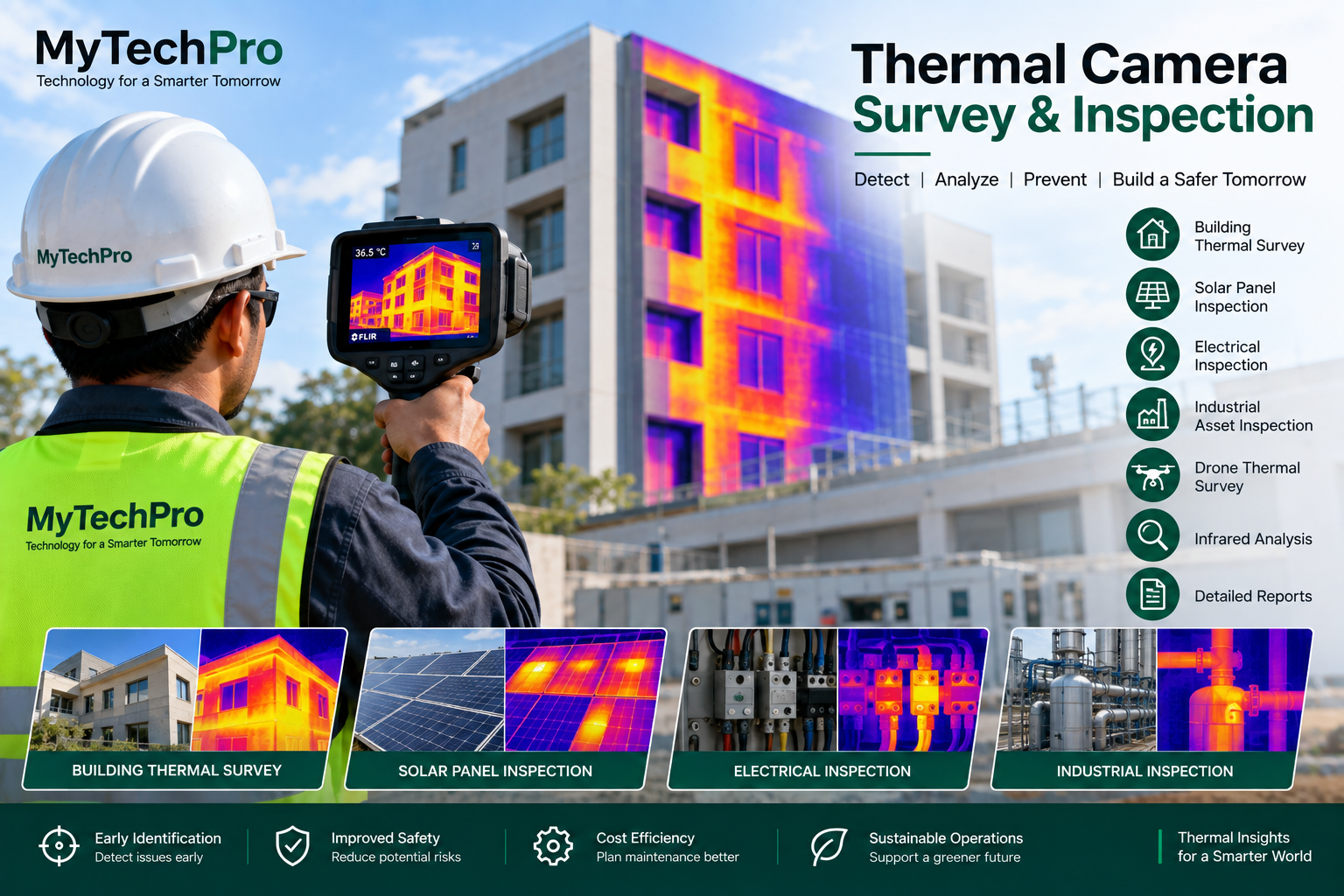
Thermal Camera Survey and Infrared Inspection
OUR CAPABILITIES

Thermal Camera Survey Services

Thermal imaging can be applied across multiple environments to visualize temperature patterns and support inspection and maintenance activities.

Thermal Imaging

Capture infrared images to visualize temperature variations across surfaces, equipment and physical assets.

Solar Panel Inspection

Thermal inspection can help identify abnormal temperature patterns across solar panels and related equipment.

Electrical Inspection

Identify thermal patterns around electrical equipment, connections, panels and other components requiring investigation.

Building Thermal Survey

Capture thermal information from buildings and structures to support investigation of heat patterns and potential problem areas.

Industrial Inspection

Support thermal inspection of industrial machinery, equipment, facilities and operational assets.

Drone Thermal Survey

Combine drones with thermal cameras to inspect large or difficult-to-access areas from an aerial perspective.

Drone Thermal Camera Survey
DRONE + THERMAL TECHNOLOGY

Aerial Thermal Inspection for Large and Difficult Sites

Combining drone technology with thermal imaging provides an aerial approach to inspecting large areas, infrastructure and assets that may be difficult or time-consuming to inspect manually.

Thermal imagery can be combined with conventional aerial photography and GIS information to provide a more complete spatial view of the inspection area.

✔ Aerial Thermal Imaging
✔ Large Area Inspection
✔ Difficult-to-Access Asset Inspection
✔ Thermal + RGB Imagery
✔ GIS-Based Inspection Mapping
✔ Location-Based Thermal Records
✔ Visual Inspection Comparison
✔ Digital Inspection Reports
APPLICATION AREAS

Where Thermal Inspection Can Help

Thermal imaging provides an additional layer of information that can support inspection, maintenance and asset management workflows.

Solar Plants

Thermal inspection of photovoltaic panels and solar infrastructure.

Electrical Systems

Thermal assessment of electrical panels, connections and equipment.

Buildings

Thermal surveys of building surfaces, roofs and selected areas of interest.

Industrial Assets

Thermal imaging for industrial equipment, facilities and operational assets.

Infrastructure

Support inspection of selected infrastructure and large physical assets.

Telecom Assets

Thermal imaging can supplement visual inspection of selected telecom assets.

Warehouses

Thermal surveys for selected areas of warehouses and industrial facilities.

Construction

Thermal imaging can complement construction inspection and documentation workflows.

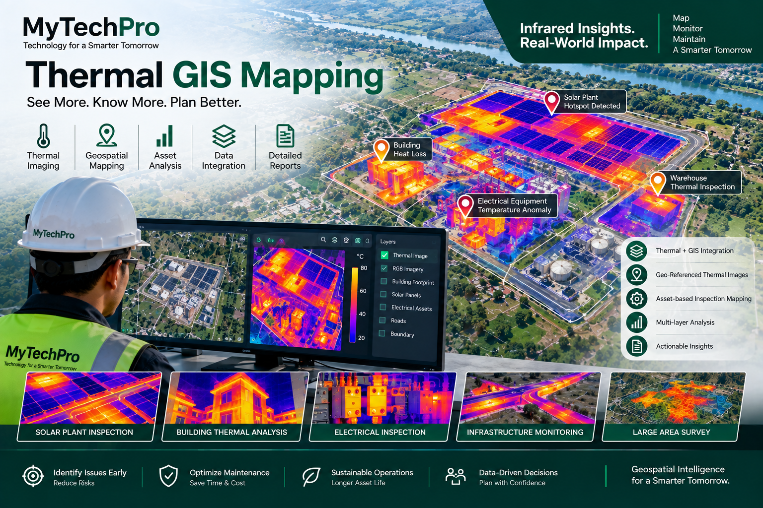
Thermal Imaging GIS Mapping
THERMAL DATA + GIS

Connect Thermal Information with Location

Thermal inspection becomes more useful when temperature information is associated with geographic location and asset information.

MyTech Professionals can integrate thermal imagery with GIS and mapping workflows to create location-based inspection records and visual inspection maps.

✔ Geo-Referenced Thermal Images
✔ Thermal Inspection Maps
✔ Asset-Based Inspection Records
✔ Thermal + RGB Comparison
✔ GIS Layer Integration
✔ Inspection History
✔ Digital Reports
✔ Spatial Asset Monitoring
OUR PROCESS

Thermal Survey Workflow

A structured workflow helps organize thermal inspection data and deliver useful digital outputs.

01. Plan

Define inspection objectives, assets, survey areas and required outputs.

02. Capture

Capture thermal and visual imagery using appropriate camera or drone equipment.

03. Analyze

Review thermal patterns and identify areas requiring further investigation.

04. Report

Deliver thermal images, inspection findings, maps and digital reports as required.

KEY BENEFITS

Add an Infrared Layer to Your Inspection

Non-Contact Inspection

Capture thermal information remotely without requiring direct physical contact with the inspected surface.

Identify Heat Patterns

Visualize temperature variations that can help direct attention toward areas requiring further investigation.

Location-Based Reporting

Connect inspection information with geographic locations and mapped assets.

Need a Thermal Camera Survey?

Talk to MyTech Professionals about thermal imaging, drone thermal surveys, solar inspection, electrical inspection, infrastructure monitoring or GIS-based thermal mapping.

Request a Thermal Survey